 In a land-scarce country like Bangladesh, the steady loss of arable land remains a pressing concern, often posing significant challenges to achieving various developmental goals. A key issue is the uncertainty surrounding the actual rate at which agricultural land is diminishing. Conflicting reports and, at times, exaggerated estimates create confusion, making it difficult to ascertain fundamental details-such as the precise extent of land currently under cultivation, the portion allocated for industrial use, and the areas absorbed by expanding human settlements.
Such information is indispensable for policymakers and urban planners, enabling them to make informed decisions on a range of issues, many of which extend beyond agriculture and food production. Effective land-use planning is essential not only for ensuring food security but also for maintaining ecological balance, optimising industrial expansion and addressing the housing needs of a growing population. Therefore, establishing a comprehensive and transparent land monitoring system-leveraging modern technology such as satellite imagery, geographic information systems (GIS), and digital land registries-is imperative. Only with accurate, up-to-date information can the nation strike a sustainable balance between development imperatives and the protection of its vital agricultural resources.
Studies conducted in the past revealed that the country was losing around 1.0 per cent of its agricultural land annually. According to an agricultural census conducted in 1983-84, the country's total agricultural land was estimated at 9.2 million hectares. A subsequent study done in 1996 showed a considerable decrease in farm lands amounting to 8.2 million hectares. This went to show the annual loss at 1.0 per cent. But findings of a study conducted few years ago by the country's lead NGO BRAC revealed a somewhat relieving picture. Between 1983 and 2008, the study says, decrease in cultivable land was to the tune of an annual rate of 0.3 per cent. A subsequent study showed the annual rate of decrease at 0.4 per cent between 2010 to 2020.
While a database of the size of agricultural lands is crucial, there is also the need for accurate data about the reclaimed lands that the government has been announcing for some time now but not providing precise information as to their size.
In recent times there is an apparent note of complacency due to bumper harvests of paddy, but the matter of food security, anticipated as a result of increased production of the staple food, does not seem to hold ground as decrease in farm lands is accompanied by a considerable decrease in the number of rural population engaged in agro profession.
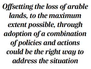
Now, while credible data is important, equally important it is to know the reasons behind the losses. The reasons are not many, but how these impact the loss and the measures needed to check are matters that require urgent attention from the concerned quarters. Offsetting the losses, to the maximum extent possible, through adoption of a combination of policies and actions could be the right way to address the situation.
It is quite clear that at the root of the loss, the number one factor is the increased demand for land as a result of an increasing population. More and more lands are required for raising homesteads, and the requirement is met mostly by agricultural lands. As per 2001 population census, the total number of homesteads in the country was 24.85 million which rose to 28.66 million as per 2018 agricultural census - at a growth rate of more than 15 per cent.
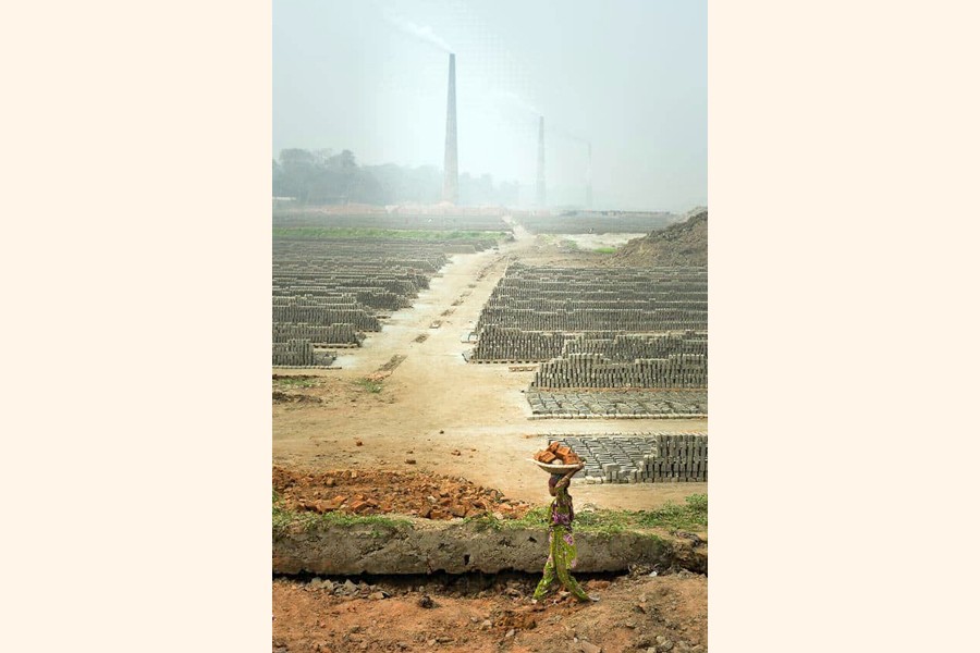
Similar is the case with the requirements of roads that come with increased population and decrease in agricultural lands. Coupled with it is the recurrence of river erosion that takes its toll on farm lands. As per estimates of the Centre for Geographic Information Services (CGIS), river erosion costs 1,600 hectares of agricultural land every year. Besides these, the menace of brick fields coming up mostly on farm lands has been a cause for serious concern for quite some time.
Looking at the overall picture, it appears that loss of farm lands could have been partly protected had there been a legal bar on the use of agricultural lands for purposes other than cultivation. Opinions expressed many a time by concerned quarters in the past to bring some legal instrument in force so that agricultural lands could be protected have gone unheeded.
While the loss of farm land is an issue of serious magnitude, there is also the need to examine a number of allied matters that need important findings by way of intensive research. For example, the need to examine economic returns of farm lands being used for non-agricultural purposes is one such. There is thus the need for research not just to update the available farm lands including those being reportedly reclaimed, but also to disseminate findings on a host of inter-related matters to facilitate macro planning.
It is here that the need for a comprehensive master plan becomes crucial-one that can identify the problems and suggest measures to address them as well as find ways to utilise arable lands in the most efficient manner.
wasiahmed.bd@gmail.com
© 2026 - All Rights with The Financial Express