BD\\\'s maritime resolution background
Tuesday, 8 July 2014
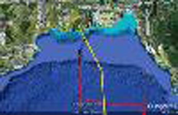
Bangladesh drew an end to its protracted maritime dispute with two neighbours as Permanent Court of Arbitration in Hague delivered a crucial verdict favouring Dhaka in its the dispute with India two years it won its case with Myanmar in another international tribunal. Bangladesh in 2010 decided to go for international arbitration in line with the provisions of United Nations Convention on the Law of the Sea (UNCLOS) as the ongoing discussions with India and Myanmar could not yield the expected results. Dhaka earlier said it kept options open for solving the disputes bilaterally though it sought the resolution in the international tribunal as the negotiations in the past several decades yielded no result. The post independence government of Bangabandhu Sheikh Mujibur Rahman established the legal entitlements of Bangladesh to the apportionment of maritime areas and exploitation of marine resources therein by passing the ‘Territorial Waters and Maritime Zones Act-1974’. ‘This was the first maritime legislation enacted by any country in the region,’ foreign minister AH Mahmood Ali said in Dhaka on Tuesday while announcing the verdict of the PCA. Official records suggest Bangladesh at that time declared 12 nautical miles (nm) of territorial sea and 200 nm Economic Zone well before such concept was even developed widely in the international arena. Bangabandhu also initiated maritime boundary negotiations with India and Myanmar and even settled the 12 nm territorial sea boundary with Myanmar in November 1974. After August 15, 1975 carnage in which Bangabandhu was assassinated, the maritime boundary issue appeared to be a matter of less importance in the priority list of post 1975 regimes. The then government under former president HM Ershad, however, signed the UN Convention on the Law of the Sea (UNCLOS), but it remained un-ratified since its adoption in 1982 while the international law which was of utmost crucial for Bangladesh was ratified after Prime Minister Sheikh Hasina-led Awami League back to power in 1996 general elections. The cabinet on July 9, 2001 ratified the UNCLOS and thus Bangladesh became full member of the convention in July 2001. After ratification of the UNCLOS in 2001, Bangladesh needed to submit scientific and technical data (seismic and bathymetric) to United Nations Commission on the Limits of the Continental Shelf (CLCS) within 10 years i.e. July 2011 for establishment of its extended continental shelf in the Bay of Bengal beyond 200nm. During Sheikh Hasina’s 2nd term in office, Bangladesh conducted the first ever dedicated seismic survey of the Bay of Bengal in March 2010 in the history of the country. Thus, after completing the most crucial task of the collection of geophysical and bathymetric data of the seabed, Bangladesh finally submitted its claim on the extended continental shelf to the UN with all supporting data on 25 February 2011, five months prior to the deadline. This initiative also opened up new opportunities of protection, preservation and utilisation of economic resources of the Bay of Bengal both within and beyond 200 nm. But the unresolved maritime boundary continued to create severe obstacles to exploration and exploitation of natural resources, affected deep sea fishing. Bangladesh Navy and the Coast Guard too experienced severe problems in exercising sovereign rights in the maritime areas claimed by Bangladesh and in safeguarding our resources like fishes from being plundered by others due to absence of maritime boundary. ‘Under the leadership of Prime Minister Sheikh Hasina, Bangladesh took a bold, visionary and timely decision for settlement of this issue through peaceful means that is compulsory dispute settlement procedure under the UNCLOS,’ the foreign minister said. On October, 8, 2009, Notice of Arbitration was issued against Myanmar and India under Part XV of the UNCLOS for delimitation of territorial sea, the exclusive economic zone and the continental shelf in accordance with international Law. Both India and Myanmar were seeking resolution of the dispute on the basis of ‘equidistance’ formula which would have narrowed down Bangladesh’s sea limit in the form of a triangle. Bangladesh, therefore, argued for settlement of the dispute on the basis of ‘equidistance formula’ for an expanded boundary and ensure its stake on the continental shelf. Bangladesh won a similar judgment in a companion case against Myanmar in 2012. The 2012 judgment was issued by the 21-member International Tribunal for the Law of the Sea (ITLOS) in Hamburg rejecting ‘equidistance’ boundaries (as proposed by Myanmar in that case) and awarded Bangladesh a sizable share of the disputed waters in the eastern part of the Bay of the Bengal, including the continental shelf beyond 200nm. The award of 2014 by the Netherlands-based arbitral tribunal which cannot be appealed, is binding on both states. It brings to an end in the arbitral process that was commenced by Bangladesh in respect of Myanmar and India under the UNCLOS in 2009, according to BSS.