Digital land survey afoot in two Sylhet upazilas
Staff shortage hits the job
Sunday, 21 June 2026
OUR CORRESPONDENT
SYLHET, June 20: Digital land survey is underway in two upazilas of Sylhet division, including Chhatak of Sunamganj and Juri of Moulvibazar district; and the process it will help better and more accurately perform field survey of land facilitating advanced documentation for private land owners and others, officials said.
As a strategically important site, field survey work initially started in Patharia hills reserve forest in Juri upazila.
Workers used drone and electronic total station (ETS) for survey of this much important area, which remained unsurveyed yet as it could not be done in 1956 due to its deep forest location. This survey would help protect the vast forest site, owned by the forest department, officials said.
Despite being declared a protected area in 1920, the Patharia Hills Reserve Forest in Juri upazila has never been surveyed, leading to multiple disputes and numerous instances of encroachment.
After 105 years, the Department of Land Records and Survey (DLRS) initiated digital survey of the reserve forest months ago, in 2025.
"The reserve forest stretches across 30km from Lathitila in Juri to Bobartal in Barlekha upazila, covering 23,520 acres. Several tea gardens are located within the area. It is also home to several ethnic groups' settlements," said an official in the forest department.
DLRS already established over 50 geodetic control points (permanent reference markers) across the forest using satellite technology for the digital survey, said assistant settlement officer Abu Bakar Siddique.
"Several survey teams, divided in groups, did the job," he said, adding, "Area map is being readied now. Then we will go for the next steps."
A number of local residents said numerous disputes over land ownership emerged over the years as no survey was conducted. This survey will pave the way for resolving the disputes.
Contacted, Sylhet divisional forest officer Abdur Rahman told this correspondent that they are yet to get the draft map of the survey. It will not only help resolve land disputes but also facilitate development of forest management strategies.
Contacted, Golam Mostafa Liton, assistant settlement officer for Chhatak, said as many as 141 moujas of Chhatak will be surveyed in phases digitally and work on 21 moujas is going on while the rest would be done subsequently.
Already as part of field work, draft maps have been prepared on four moujas while field survey is going on in seven others.
However, due to excess rains and submersion of low lying areas in recent weeks, the work had been suspended for weeks. Staff shortage is also a problem that hinders the job.
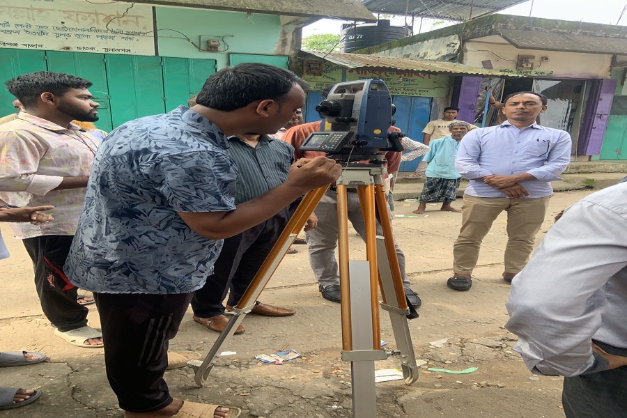
During a visit to Aliganj Bazar of Chhatak on Tuesday, this correspondent saw the survey work was going on in presence of a good number of locals.
Zonal settlement officer Sonia Sultana, also in-charge of the land survey department, Sylhet, told this correspondent that due to staff shortage the job is being hampered. However, they were trying to complete the work, she added.
The Patharia Hills Reserve Forest in Juri upazila on Bangladesh-India border covers approximately 23,520 acres (about 95 square kilometers. This transboundary subtropical forest extends across the Juri of the Moulvibazar district, Bangladesh, and stretches into the neighbouring state of Assam, India.
The total area spans a contiguous region of hill ranges, streams, and tea gardens.
Due to a lack of surveying since its initial declaration as a protected area in 1920, exact boundaries have historically been disputed. The comprehensive digital survey of the area will help prevent encroachment, officials said.
forsylhet@gmail.com