
Mawa-Kewrakandi route shrinking despite dredging
Tuesday, 11 February 2014
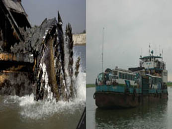
Despite a dredging work done for long 6 months on the 13-km-long Mawa-Kewrakandi river route by Bangladesh Inland Water Transport Corporation (BIWTC) to keep ferry plying smooth, about 11-km stretch of the route from Louhajong turning point in Munshiganj district to Kathalbari ferry ghat (terminal) has remained narrow still creating acute navigability problems. BIWTC sources said water level in the Padma River has fallen to its lowest during the ongoing dry season, creating hazards for movement of ferries with vehicles, including buses and goods-laden trucks, on the route which is one of the main gateways to the south-western region of the country. Even the BIWTC informed the problem to the Bangladesh Inland Water Transport Authority (BIWTA) attaching great importance. The sources also said fall in the water level of the river will continue till mid-March. As a result, nine kilometers of Mawa-Charjanajato route from Louhajong turning point, about 2.5 kms off Mawa Ferry Gaht, to Kathalbari point has become narrow at different places. Ferry movement on the route has become risky as although two ferries ply at the same time, one cannot overtake another. During tides, there is water flow of about nine and a half feet at the deep Louhajong point and the nearby areas of main channel of Kathalbari ferry ghat and that depth lessens by about 2 feet during ebb. On the other hand, water flow at the point of Kewrakandi No. 2 Ferry Ghat pontoon has also decreased. Loose soil at the point adds to more danger to the ferry plying there. BIWTC marine officers M Shahjahan and Ahmad Ali said constant decline in the water flow of the river has created a vulnerable situation from Louhajong turning point to Kathalbari ferry ghat, posing a threat for smooth navigation, according to UNB.