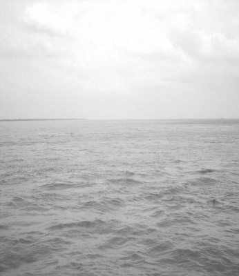
 A partial view of the seemingly limitless Padma
 Bangladesh is a riverine country. About 800 rivers including tributaries flow through the country constituting a waterway of total length around 24,140 km. Most of the country's land is formed through silt brought by the rivers. The rivers of Bangladesh are particularly amenable to breeding and raising fish, and aquaculture is the source of more than two-fifths of the country's fish yield. However, the rivers and seacoast also offer opportunities for open-water fishing, mostly in the estuaries of the Bay of Bengal.
The mighty river Ganges, which begins in the Indian state of Uttar Pradesh, enters Bangladesh from the North West through Rajshahi Division. It joins the Brahmaputra in the centre of the country, North West of the capital, Dhaka. The Ganges changes its name to Padma as it passes into Bangladesh, while the main flow of Brahmaputra is known as Jamuna. It is these great rivers and their countless tributaries that have the most apparent effect on the landform - constant erosion and flooding over the alluvial plains change the course of rivers, landscape and agriculture. The Jamuna alone is estimated to carry down 900 million tonnes of silt each year.
Rivers are the most important geographical features in Bangladesh, and it is the rivers that created the vast alluvial delta. It has been known that the outflow of water from Bangladesh is the third highest in the world, after the Amazon and the Congo systems. The Padma, Jamuna and the lower Meghna are the widest rivers.
Bangladesh is proud of its vast rivers and therefore affectionately called 'the Land of Rivers' by its people. Every year they enrich the soil and make it more fertile. At the same time they also cause immense loss of lives and wealth when the devastating floods occur. The best way to see the real beauty of Bangladesh and its rivers is by taking a boat trip on the rivers. A trip from Dhaka to Khulna on board the famous Paddle Steamer through some big and small rivers gives you the opportunity to witness this unique beauty.
The Jamuna River is one of the three main rivers of Bangladesh. It is the main distributaries channel of the Brahmaputra River as it flows from India to Bangladesh. The Jamuna flows south and joins the Padma River, near Goalundo Ghat, before meeting the Meghna River near Chandpur. It then flows into the Bay of Bengal as the Meghna River. The Brahmaputra-Jamuna is a classic example of a braided river and is highly susceptible to channel migration and avulsion.
The Jamuna is a braided stream characterized by a network of interlacing channels with numerous sandbars enclosed in between them. The sandbars, known in the Bengali as chars do not, however, occupy a permanent position. The river deposits them in one year very often to destroy and redeposit them in the next rainy season. The process of deposition, erosion and re-deposition has been going on continuously making it difficult to precisely demarcate the boundary between the district of Pabna on one side and the districts of Mymensingh, Tangail and Dhaka on the other. Breaking of a char or the emergence of a new one is also a cause of much violence and litigation.
In Bangladesh, the Brahmaputra is joined by the Teesta River, one of its largest tributaries. The Teesta earlier ran due south from Jalpaiguri (India) in three channels, namely, the Karatoa to the east, the Punarbhaba in the west and the Atrai in the centre. The three channels possibly gave the name to the river as Trisrota (possessing three streams) which has been shortened and corrupted to Teesta. Of these three, the Punarbhaba joined the Mahananda. The Atrai passing through a vast marshy area known as Chalan Beel joined the Karatoa and the united stream joined the Padma (Ganges) near Jafarganj. In the destructive floods of 1787, the Teesta River forsook its old channel and rushing south-east it joined the Brahmaputra.
James Rennell made a survey between 1764 and 1777 and his maps are one of the earliest authentic maps of Bengal in existence. In these maps Teesta is shown as flowing through North Bengal in several branches - Punarbhaba, Atrai, Karatoa, etc. All these streams combined lower down with the Mahananda, now the westernmost river in North Bengal, and taking the name of Hoorsagar finally discharged into the Ganges at Jafarganj, near modern Goalundo. The Hoorsagar river is still in existence, being the combined outfall of the Baral, a spill channel of the Ganges, the Atrai, the Jamuna or Jamuneswari (not the main Jamuna through which the Brahmaputra now flows), and the Karatoa, but instead of falling into the Ganges, it falls into the main Jamuna, a few miles above its confluence with the Padma at Goalundo. James Rennell's 1776 map shows the Brahmaputra's main flow through Jamalpur and Mymensingh and a much narrower Jamuna or Jamuneswari before an earthquake in 1762, and the Teesta River flowing in 3 channels to the Ganges before a flood in 1787.
Below the Teesta, the Brahmaputra splits into two distributaries branches. The western branch, which contains the majority of the river's flow, continues due south as the Jamuna to merge with the lower Ganges, called the Padma River. The eastern branch, formerly the larger but now much smaller, is called the lower or old Brahmaputra. It curves southeast to join the Meghna River near Dhaka. The Padma and Meghna converge near Chandpur and flow out into the Bay of Bengal. This final part of the river is called Meghna. The Meghna is a distributary of the great river Brahmaputra. The Meghna is formed inside Bangladesh by the joining of the Surma and Kushiyara rivers originating from the hilly regions of eastern India. Down to Chandpur, the Meghna is hydrographically referred to as the Upper Meghna. After the Padma joins, it is referred to as the Lower Meghna. The Meghna is the widest river among those that flow completely inside the boundaries of Bangladesh. At one point near Bhola, the Meghna is 12 km wide.
In the past, the course of the lower Brahmaputra was different and passed through the Jamalpur and Mymensingh districts. In a 7.5 magnitude earthquake on April 2, 1762, the main channel of the Brahmaputra at Bhahadurabad point was switched southwards and opened as Jamuna due to the result of tectonic uplift of the Madhupur tract. The Jamuna is a very wide river. During the rains it is about 8.0-12.9 km from bank to bank. Even during the dry season when the waters subside, the breadth is hardly less than 3.2-4.8 km.
The Jamuna was a barrier in establishing a direct road link between capital Dhaka and northern part of Bangladesh, better known as Rajshahi Division, until 1996. This was mitigated by the completion of the Jamuna Multi-purpose Bridge. It is also a very important waterway. It is navigable all the year round by large cargo and passenger steamers. Before the Partition of Bengal in 1947, passenger steamers used to ply up to Dibrugarh in the state of Assam in the Indian Union. At present two steamer ferry services link the district of Pabana with the districts of Mymensingh, Tangail and Dhaka. The Bangladesh Railway maintains a ferry service between Sirajganj adjacent to Pabna and Jagannathganj in Jamalpur. The other ferry services between Nagarbari in Pabna and Aricha in Manikganj adjacent to Dhaka and Aricha and Doulatdia in Rajbari adjacent to Faridpur are run by the C & B Department.
The situation in Bangladesh is very similar to that in the Netherlands as it is in Louisiana with the Mississippi delta. All these countries are at downstream, they are faced with the erosion of their coastline and are completely dependent on other countries that are at upstream and control the amount and the quality of water that comes downstream. Every year, Bangladesh, one of the world's poorest nations, must dig itself out of the flood damage and build new roads after India unloads its dams without warning.
India is planning to withdraw water from Bangladesh's major river, the Brahmaputra, which supplies 65 per cent of all the fresh water in Bangladesh. The Indian government plans to cycle off water from the great river and divert it through 40 new canals into southern India. It is a project that will cost India US$120 billion. This mega-plan is called the "River Interlinking Project" which the Indian government hopes to complete within a decade and thereby two-thirds of Bangladesh could become a desert. So what India is doing is transferring the Brahmaputra water before it enters Bangladesh to take it around this country through the Chicken's Neck and then let the water flow first to the Ganga, then to the Mahanadi and then lower down to the other states to the ruin of Bangladesh ecology.
The writer is a retired Professor of Economics, BCS General Education Cadre. Email: sarwarmdskhaled@gmail.com
© 2026 - All Rights with The Financial Express