GENEVA, July 03 (Agencies): El Nino is here and will quickly develop into a strong event between July and September, fuelling the likelihood of extreme weather, the United Nations' climate agency warned Friday.
The World Meteorological Organization (WMO) said the climate phenomenon would rapidly gain strength, as it warned countries to brace for impact.
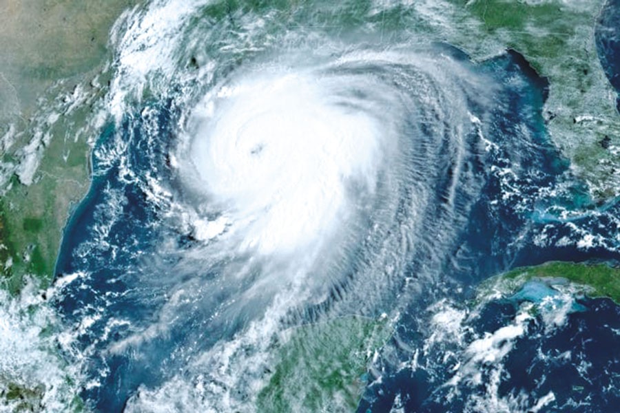
El Nino warms surface temperatures in the central and eastern equatorial Pacific Ocean, bringing worldwide changes in winds, pressure and rainfall patterns.
It typically takes place every two to seven years and lasts around nine to 12 months.
Conditions oscillate between El Nino and its opposite La Nina, with neutral conditions in between.
The WMO's monthly Global Seasonal Climate Update points towards "a rapid development into a strong El Nino event during July-September".
The UN agency classifies El Nino events as weak, moderate, strong or very strong, meaning it is set to reach the third-highest level out of four.
"El Nino conditions have developed in the tropical Pacific and are forecast to strengthen rapidly over the coming months, increasing the likelihood of... extreme weather events in many parts of the world," the WMO said.
WMO climate scientist Alvaro Silva told a press conference that since last
month, "we have much more confidence that strong El Nino conditions are developing in the equatorial Pacific".
He said the WMO may issue an update in the coming months, "for example, if we have forecasts suggesting this will be a really strong El Nino".
The Geneva-based agency said forecasts produced by global climate centres, using different models, indicate a consistent and significant warming of ocean temperatures across the central and eastern equatorial Pacific.
"Seasonal-average sea-surface temperature anomalies expected to exceed 2C in key monitoring regions," it said.
"El Nino is expected to continue strengthening during the Northern Hemisphere autumn, with its influence extending across many regions of the globe."
The last El Nino contributed to making 2023 the second-hottest year on record and 2024 the all-time high at around 1.55C above the 1850-1900 pre-industrial average.
While El Nino usually peaks between November and February, the resulting spike in temperatures typically comes later.
"The impacts of El Nino will be felt in different regions until the end of the year and beyond, also during 2027," underlined Silva.
The WMO said it was stepping up early warning support to help guide preparedness, especially in climate-sensitive sectors like agriculture and health.
Meanwhile, Residents of Guam and the Northern Marianas boarded up windows and stocked up on provisions Friday as a monster weather system forecast to become a "super typhoon" barrelled towards the US Pacific territories.
As of 0300 GMT Friday, Typhoon Bavi was moving between the Marshall Islands and the Northern Marianas, with sustained winds of 167 kilometres per hour (104 miles per hour) and gusts of 203 kph, according to the Joint Typhoon Warning Centre (JTWC).
"Current forecast tracks continue to indicate a grim outlook for the Marianas," the US National Weather Service said.
"All residents across Guam and the [Northern Mariana Islands] should plan for and anticipate at least tropical storm conditions."
© 2026 - All Rights with The Financial Express