 Dana, a possible severe-to-very severe cyclone, is set to make a landfall on October 25, causing concern for another disaster in the coastal region.
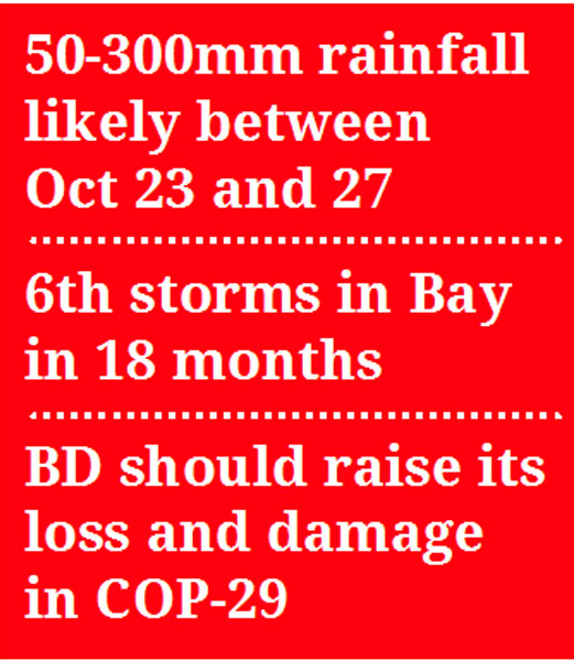
It would be the sixth oceanic storm that might occur just in 18 months along Bangladesh coast.
Climatologists and meteorologists said cyclone is taking place frequently in the Bay of Bengal due to the global climate change, causing massive losses of lives, crops, livestock, fisheries and infrastructure in Bangladesh.
Experts in climate finance urged for forming a mechanism to calculate the loss and damages due to the random storms to raise it in the UNFCCC.
Analysis of images from Japan's artificial geosatellite indicates that a well-defined low pressure system over the Bay has strengthened in the last 24 hours, developing into a low pressure area between 10:00AM and 12:00PM Tuesday.
As of 2:00pm on Tuesday, the centre of this low pressure system is located at approximately 16 degrees north latitude and 90.5 degrees east longitude, with wind speeds around the centre reaching 55 km/h.
The depression is situated about 650km southeast of Khepupara in Patuakhali district.
According to the latest forecast from the European Union weather model on October 22, cyclone Dana is expected to pass over the coast between Puri in Odisha state and Sagar Island in West Bengal between 12noon on October 24 and to develop into a severe cyclonic storm by 12noon on October 25, with wind speeds ranging from 89 to 117 km/h.
As a result, the likelihood of cyclone Dana impacting Bangladesh has decreased somewhat, said an official at the Bangladesh Meteorological Department (BMD).
Current weather models predict that cyclone Dana could make landfall approximately 200km to the right of its expected trajectory, allowing for about three days of adjustments before landfall.
The well-marked low pressure system is moving northwest and is expected to continue in this direction for the next two days.
The surface water temperature at the depression's location is currently 30 degrees Celsius.
It is important to note that favourable conditions for cyclone formation exist where water temperatures exceed 26 degrees Celsius.
The current temperature in the Bay will likely continue to rise as the system moves north and northwest, raising concerns that the low pressure will strengthen over the next three days.
The cyclone is anticipated to reach maximum intensity before making landfall, with wind speeds expected to peak at 110 to 120 km/h, with gusts possibly reaching 130 km/h.
However, the country is going to witness the sixth cyclone 'Dana' in the last one and a half years, the last two cyclones in August 2023 named Hamoon and May 2024 named Remal claimed above 30 lives and caused massive damage for crops, livestock, fisheries, houses and other infrastructures, according to the ministry concerned.
However, other cyclone like 'Mocha' made its mark in May 2023, followed by Hamoon in August the same year, according to the BMD.
November 2023 saw the arrival of Midhili and November and December were marked by the fury of cyclone Michaung.
BMD director Dr Sadequl Alam says cyclone has now been random in the Bay of Bengal compared to that of four-five decades back.
Bangladesh witnessed above 49 cyclones since 1960 of which 20 cyclones happened since 2007 and latest Dana would be the 21st in last 24 years.
Super cyclones like Sidr, Aila, Fani, Mahasen, Amphan and Remal occurred during the period.
In between 1970 and 1971, the country faced three cyclones in a row. But the record of the last one and half year (from May 2023 to October 2024) passed all records, he said.
Prof AKM Saiful Islam of Institute of Water and Flood Management at Bangladesh University of Engineering and Technology said that ocean temperature has been rising amid the global warming.
tonmoy.wardad@gmail.com